Peace for the World World ! Your War Our Lives

The Dalai Lama
A Brief Colonial History Of Ceylon(SriLanka)
Sri Lanka: One Island Two Nations
A Brief Colonial History Of Ceylon(SriLanka)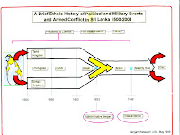
Sri Lanka: One Island Two Nations
(Full Story)
Back to 500BC.

Friday, December 18, 2020
Province-based Devolution in Sri Lanka: a Critique


by G H Peiris-December 17, 2020
Continued from Wednesday 16
Those provincial boundaries have remained almost unchanged during the
past 131 years, in disregard of ecological, demographic, economic and political transformations. What prevails now is an archaic and outmoded design that catered to different needs and bureaucratic circumstances.
The provincial administrative system had
only nominal contact and control over many functions of government. Those that were under the direct control of the government such as administration of justice, security, health services, road construction, land development, major hydraulic systems, postal and telecommunication services, railways, etc., were centrally controlled and invariably had sub-national spatial networks of their own.
In addition, and more significantly than all else, throughout British rule there was no irredentist threat from the Indian Sub-Continent which was largely under British rule. Nor did ‘Ceylon’ face serious external threats of destabilisation or conquest except, briefly (in 1942), during the Second World War.
Accordingly, an attempt to conduct Provincial Council elections without changing the existing configuration of provinces is tantamount to disregarding the fact that the continued existence of the present network of provinces, while not achieving effective empowerment of the under-represented and impoverished segments of our population, perpetuates the irredentist threat to the sovereignty and territorial integrity of Sri Lanka. It also ignores the ‘never again’ mandate offered by the people to the present government at the Parliamentary elections conducted last August for a major constitutional overhaul involving, inter alia, province-based devolution.
When the Dutch possessions in Sri Lanka, transferred to the British in 1796, were granted the status of a Crown Colony in 1801, the existing system of regional administration that had consisted of three ‘Collectorates’ was replaced with a network of thirteen ‘Provinces’, each centred on the coastal town after which it was named.
That arrangement, along with a separate administration over the ‘Kandyan Provinces’ annexed by the British in 1815, lasted with some modification until the Colebrooke-Cameron Reforms of 1833 when a unified system of administration embracing the entire country was established. These reforms entailed, inter alia, the setting up of a hierarchically arranged system of regional administration in which five ‘Provinces’, each under the authority of a Government Agent, constituted the basic spatial frame. The Provinces were subdivided into Districts, each comprising several Headman’s Divisions. In many instances, the Headman’s Divisions had some correspondence to the pre-British administrative units of the Portuguese and the Dutch in the lowlands and of the Kandyan kingdom in the highlands.
Yet, in demarcating the Provinces and the Districts, hardly any attempt was made either to draw from history or to accommodate the geographical realities pertaining to criteria such as access to physical resources, resource management, composition of the population, and the interdependence of the different parts of the country from the viewpoint of their development prospects. In practical terms, the main rationalisation of the provincial demarcation appears to have been that of using the best fortified coastal urban centres left behind by the Dutch (Colombo, Galle, Jaffna and Batticaloa), and the capital of the former Kandyan kingdom as bases for developing a system of control over territory, most of which was yet to be explored.
Indeed, it almost seems as if, in establishing a uniform administrative system over the entire country, and in dividing the country into Provinces and Districts, the British made a conscious attempt to move away from tradition as a means of consolidating their hold over the country.
The most pronounced feature of the provincial framework instituted through the reforms of 1833 was the annexation of the outlying territories of the former Kandyan kingdom to the coastal provinces. For instance, while Nuwarakalāviya was included in the Northern Province, Tamankaduwa and a large portion of Uva were placed within the Eastern Province. Likewise, while the Western Province was made to extend well into the Kandyan territories of the western flanks of the Central Highlands, parts of Sabaragamuwa and Uva were incorporated into the Southern Province. It has been asserted (Mills, 1964:68; de Silva, 1981:261-2; Kodikara, 1991:4-5) that the new arrangement amounted to a dismemberment of the former Kandyan kingdom, and was intended, in the words of Mills, “… to weaken the national feelings of the Kandyans”.
British administrative Demarcations of 1833
Superimposed on John Davy’s 1821 demarcation of the Kandyan Kingdom
NOTE: This illustration confirms the submissions by Mr. Samanthe Ratwatte at the SEC meeting on 3 December 2020 on the dismembering of the Kandyan Kingdom by the British in 1833.
Over the next few decades, as population and economic activities expanded, new provinces were carved out of existing ones, bringing their total number to 9 by 1889.
The provincial administration, as indicated by the content of their ‘Annual Reports’, though nominally entrusted with a wide range of functions, was largely concerned during these times with the tasks of revenue collection, infrastructure development in the form of minor construction works, and the monitoring of living conditions among the people. The government activities directly relating to the emerging modern sector of the economy, the administration of justice, and the maintenance of law and order were, for the most part, orchestrated from Colombo. Thus, the creation of new provinces – North-Western Province in 1845, North-Central Province in 1873, Uva Province in 1886, and Sabaragamuwa Province in 1889 – was, in effect, not much more than a process of increasing the number of urban centres used as the principal bases of regional administration. The provinces were not intended to serve as spatial units for the devolution of government authority except in matters of routine administration; nor were they expected to acquire an ‘identity’ in a political sense. In fact, as Governor Ridgeway observed (Administration of Ceylon, 1897:52-53) almost at the end of the 19th century:
“The existing map of the island, compiled chiefly from General Fraser’s map made early in the century, contains errors so numerous and so gross as to make it useless for administrative purposes. For example, 400 miles of provincial boundaries are still un-surveyed. Only three of the larger rivers have been completely surveyed, while in the case of the largest in the island, the Mahaveli Ganga, there is a gap of over 20 miles.”
The provincial demarcation as it stood in 1889 has remained unchanged for well over 130 years. Intra-provincial administrative adjustments were made at various times bringing the total number of Districts in the country from nineteen in 1889 to twenty-five at present. Government Agents of the provinces, holding executive power over their areas of authority, coordinated a range of government activities in their respective provinces. It is important to note, however, that in certain components of governance, while the related regional demarcations did not always coincide with provincial and district boundaries, the Government Agent had either only marginal involvement or no authority at all. This was particularly evident in fields such as the administration of justice, maintenance of law and order, and the provision of services in education and health care, in which there is large-scale daily interaction between the government and the people.
Post-Colonial Territorial Divisions
In the early years of independence, with the passing of the Administrative Districts Act No. 22 of 1955, the province lost whatever importance it had up to that time as a unit of regional administration. Since then, until 1987, the district served as the main unit of regional administration, acquiring, with the increasing politicisation of bureaucratic activities in the country, some recognition as a spatial entity to which the powers and functions of the central government could be decentralised (de Silva, 1993:109-116). A series of reforms implemented since 1973 –the setting up of District Political Authorities, post of District Ministers, District Development Councils, and District Planning Units– not only had the effect of institutionalising the process of increasing political control over the administrative machinery, but also enlarged the range of decision-making functions performed at the level of the district.
From perspective of the SEC, changes that were introduced under the so-called ‘Thirteenth Amendment to the Constitution’ and the Provincial Councils Act of 1987 could be seen, not merely as a revitalisation of the concept of the province as a unit of administration to which certain routine functions of the central government are decentralised, but as an attempt to grant political recognition and distinctiveness to the province as a unit of territorial control, and thus make the spatial framework of provinces the unit of devolution of government power from the Centre to the Regions. This latter, as the observations made above indicate, is a feature which the provincial network left behind by the British never possessed and was, in fact, never intended to possess.
The legislation to establish a system of Provincial Councils, drafted in the course of negotiations that led to the ‘Indo-Lanka Accord’ (a.k.a. Rajiv-JR Pact’) of 1987, was passed by parliament in November that year amidst fierce opposition from both the Sri Lanka Freedom Party (SLFP), the main party in the parliamentary opposition, as well as the Janatha Vimukthi Peramuna (JVP/People’s Liberation Front) which was engaged in an anti-government insurrection at that time. It provided for the transfer (subject to overall control of the central government) of a fairly wide range of powers and functions to councils elected at the level of the provinces. The powers vested by the Act on the president of the country vis-à-vis the Provincial Councils included that of appointing the ‘Provincial Governors’ and, more importantly from the viewpoint of the present discussion, the discretion of permitting the merger of provinces on a permanent or temporary basis to constitute an area of authority of a single council. The power to dissolve a provincial council was also vested in the president.
The clauses of the Provincial Councils Act pertaining to the merger of provinces were exercised by the president in September 1988 to bring about a merger of the Northern and Eastern provinces. This was a response to what had become an unequivocal demand of the Sri Lankan Tamils. The merger decision was intended to be temporary, pending the verdict of the inhabitants of the areas concerned at a referendum on whether it should be made permanent. Though the ‘North-East Provincial Council’, elected to office two months later, survived only until the final stages of withdrawal of the Indian Peace-Keeping Force from Sri Lanka. On the basis of a Supreme Court decision in 2006 which held that the temporary merger of the Northern and Eastern Provinces was no longer valid in law, the two provinces were demerged for the continuing operation of the Provincial Councils Act of 1987.
* * *
The antecedents of the PC system sketched above constitute only two sets of reasons that justify the appeal for its abolition. There are others, the most important among which are the blatant malpractice, extravagance and waste which it has involved all along. As one of our most venerated monks (a staunch source of support and constructive criticism of the ‘regime’) asked last night (13 December) in the course of his comments on the contemplated staging of PC elections, why is it, with all the power you already have, necessary to create more positions of privilege to your henchmen? As reported by the ex-Commissioner of Elections, the last parliamentary elections cost the government a staggering 15 billion rupees.
Burdened, as we are, with the necessity for pandemic precautions, island-wide PC elections will probably cost even more. With that level of expenditure, surely we can achieve a great deal of empowerment of those in dire poverty.